
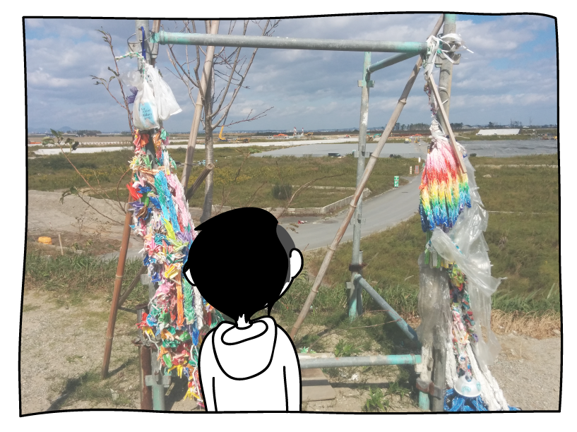
Looking out from the shrine in Yuriage, Japan
I’ve experienced three earthquakes (that I’m aware of) in my life, two of them happen to be during my short stay in Sendai City, Japan. They weren’t a big deal. The first one happened while I was taking a cat nap, at first I actually thought that my leg was twitching, but then it grew a little stronger and my clothes hanging on their hangers swayed side to side. The second one happened during a lab seminar. Someone said “地震でしょう”, “It’s probably an earthquake”, and we sat around the conference table in silence until the trembling stopped. So by now I’m pretty convinced that earthquakes are a common phenomenon here, but I’m going to focus this post primarily on the big one that happened a few years ago.
So it’s coming close to 5 years since the 2011 Tohoku Earthquake & Tsunami has happened. It was a magnitude 9 Earthquake that happened in the sea that primarily affected North Eastern Japan in the Iwate, Miyagi, and Fukushima prefectures. If you guys rewind your brains a little further back you’ll probably remember that this was the disaster that caused a nuclear meltdown in Fukushima, but mainly I’m going to talk about the event in the context of the places I’ve visited which is primarily in Miyagi.

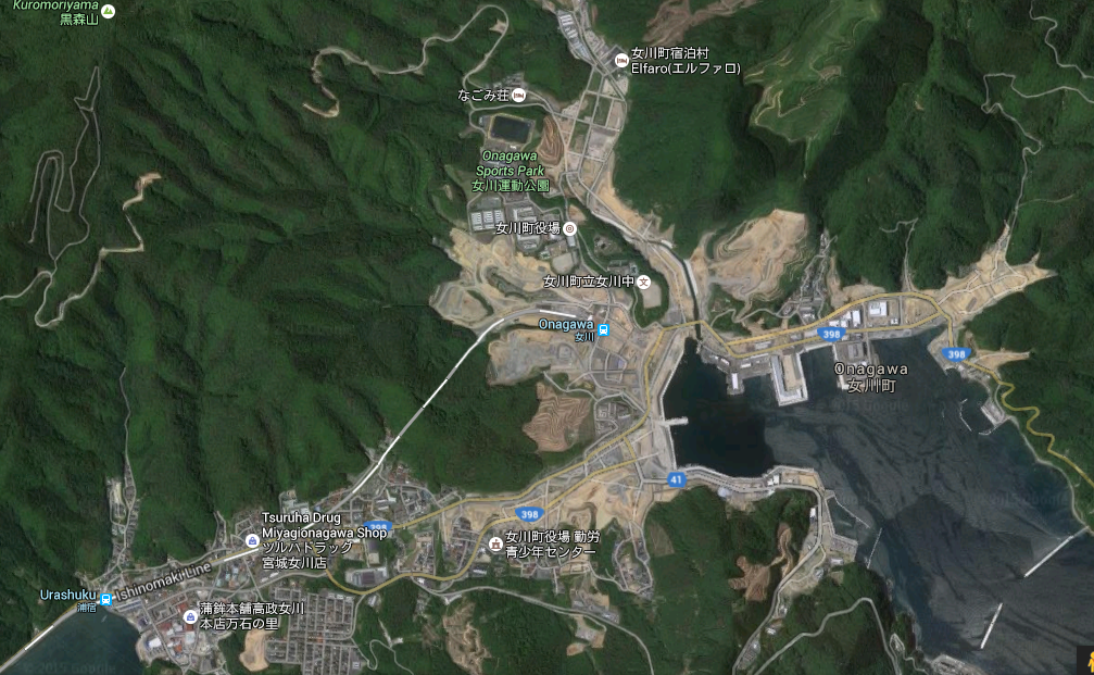
A map of Miyagi prefectures and the places I’m going to go into more detail later
The Tohoku Earthquake & Tsunami was one of the most devastating tragedies in modern Japanese history with about ~16000 deaths, costing trillions of yens in damages. The earthquake wasn’t too terrible by itself, but the tsunami it triggered was the primary cause of all the lives and properties lost.
At its highest the tsunami was recorded to be around 40 meters tall, which is kind of like if you had a 13 story building rush in towards you from the sea. The tsunami enveloped these coastal cities, sweeping away entire houses and the people inside them. Those houses then traveled, crashing into other houses, sweeping away more people, and when the tsunami finally traveled far enough inland, it receded, bringing the debri back into the sea, barraging the already beat up landscape from the other side. Since waves naturally ebb and flow, the “tsunami” isn’t a singular event but a cycle of destruction that happened several times before damping out.
If you live near the sea, one of the first steps people tell you to take after a major earthquake is to evacuate to higher ground. Lulled into a false sense of security by inundation maps created from past tsunami data marking their houses in the “safe zones” some people didn’t evacuate; some people found out that the second floor of their house was not high enough much too late; some houses were not strong enough to withstand the tidal wave. In the coastal areas of Tohoku there were entire communities that were wiped out.
Where I live in central Sendai there aren’t many remnants of the 2011 earthquake. Perhaps it’s more obvious to the locals who have seen the before and after but for me the only thing I’ve been here for is the repaving of the road leading up to the engineering campus.
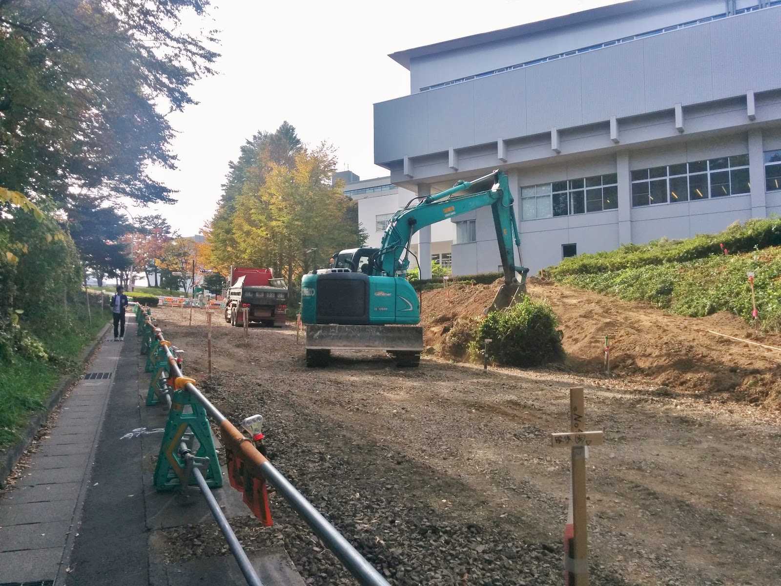
That excavator there was rolling that ball of twigs around, and I thought it was funny
Other than that, on the 5th floor of the architecture building there are a bunch of tiny strips of masking tapes pointing to small cracks on the floor. Not sure how the cracks formed and not sure exactly why they're marked, maybe part of someone’s research project.
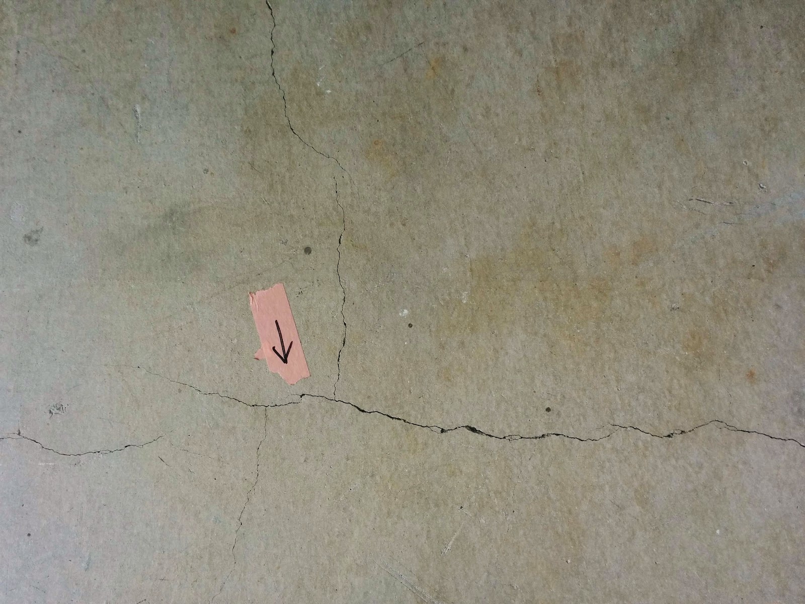
They’re seriously all over the place!

Temporary housing units in Sendai, most of them seemed vacant when we visited
Since the disaster destroyed so many houses, displacing so many people, the Japanese government erected many temporary houses in various parts of the Tohoku region. People could live in these houses for free while they picked their lives off the ground and saved money to either buy or build a new house. Temporary houses are kind of what they sound like, they were made to last for two years and then be torn down, but now as we’re approaching the 5th year since the disaster there are still people living in them who just can’t afford to move out. Most of these people are retired senior citizens.
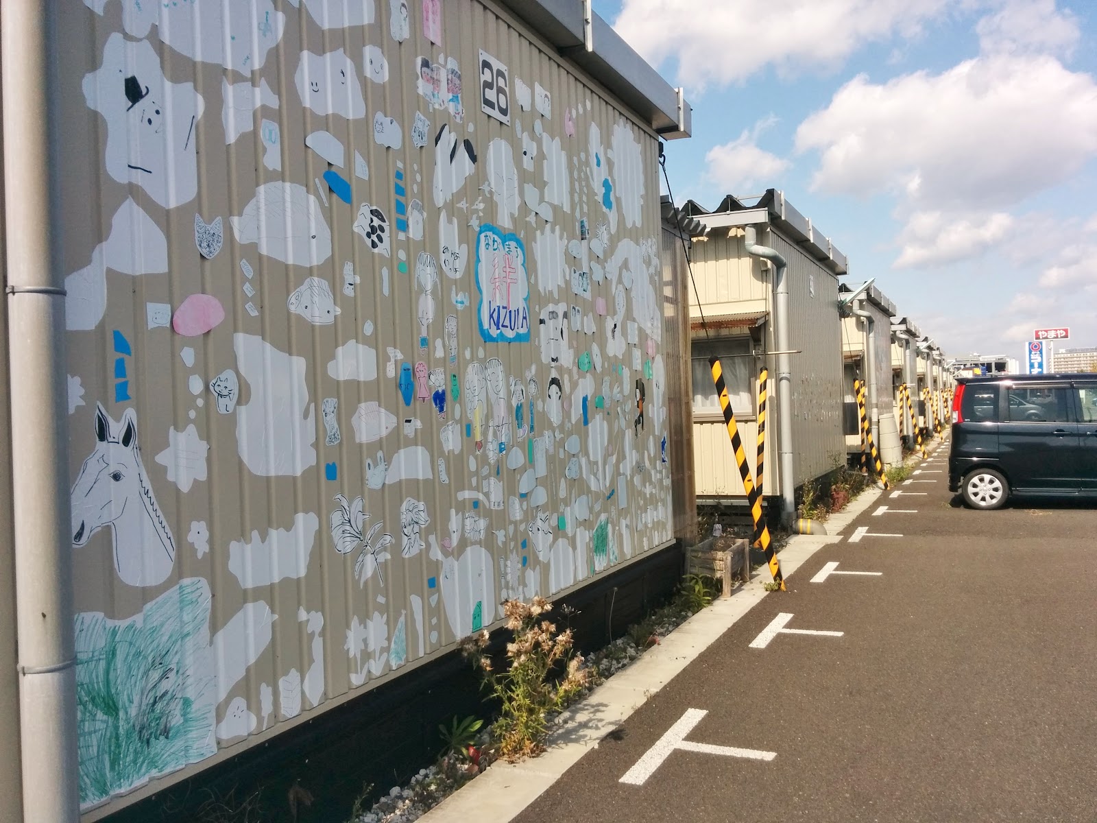
Paintings on the side of some of the housing units. They brightened up the otherwise drab beige.
So I’ve had the opportunity to see some of the reconstruction in the Miyagi Area, specifically Yuriage, Ishinomaki, Onagawa, and very soon Kawaishi.
Yuriage

Yuriage sits along the shoreline and is 30 minutes south of Sendai in Natori. When we got there the place was pretty much overgrown with these straw colored reeds. Hidden within the grass, my lab mates would point to concrete foundations that were once homes as we drove down the empty road. In Yuriage we saw lines of trucks carrying dirt to reconstruction areas where they were trying to raise the level of the land so that people could rebuild their lives there. Other than the people on the reconstruction site and the people visiting the shrine there was pretty much no one.

Looking over all the empty lots (空き地) in Yuriage

A sign I found in Yuriage, which kind of shows you their plan to raise the entire town
Ishinomaki
Standing in an area near the harbor, watching construction, it was a rainy day
Ishinomaki city was one of the cities that was hit the hardest, reporting the most number of deaths from the disaster (3000~). The first area we visited was the southern port of Ishinomaki near it’s downtown area. That place used to be a residential area, and if it was like any Japanese community I’ve seen, every square kilometer was probably packed with as many houses as they could fit.

Ganbarou Ishinomaki!
When we got there though it was completely leveled. While walking around we visited memorial area called “Ganbarou Ishinomaki” which translates to “do your best Ishinomaki” where people had planted a few flowers. There was also a tall pole that had a sign on it that said “tsunami inundation line,” you could probably stack me four times up and I would have still drowned. This place has plans to be turned into a memorial park sometime in the near future.

A still standing but vacant building
We then went further downtown and while it was much more lively than the previous area, you could still see ghost buildings that had been abandoned after the disaster. While we were there we visited the Central Ishinomaki Tohoku Earthquake & Tsunami information center where you could find pamphlets, pictures, guides, to help you understand the magnitude of the effect of the disaster on Ishinomaki and its reconstruction plans. Since then Ishinomaki's population has been steadily sinking starting from approximately 160,000 people at the time to approximately 140,000 people now. Ishinomaki has been migrating entire communities further inland in its coastal areas. This is happening all over Japan where younger people are moving out of these smaller cities leaving the older population behind and the fear is that these cities would eventually die, not only that but Japan’s population growth is actually decreasing with a birthrate (1.4babies/woman/lifetime) that isn’t enough to equilibrate the population.
Onagawa
You can kinda see in the map all the construction going on in the area
Onagawa town is strangely situated, surrounded by Ishinomaki City bordered by the sea. The reason for that is a while back, Japan encouraged smaller cities to join together to form bigger mega cities, but Onagawa town did not want to conglomerate with its fellow cities since it had a nuclear reactor which meant that they reaped special government benefits that they didn’t want to share with a larger swatch of land.

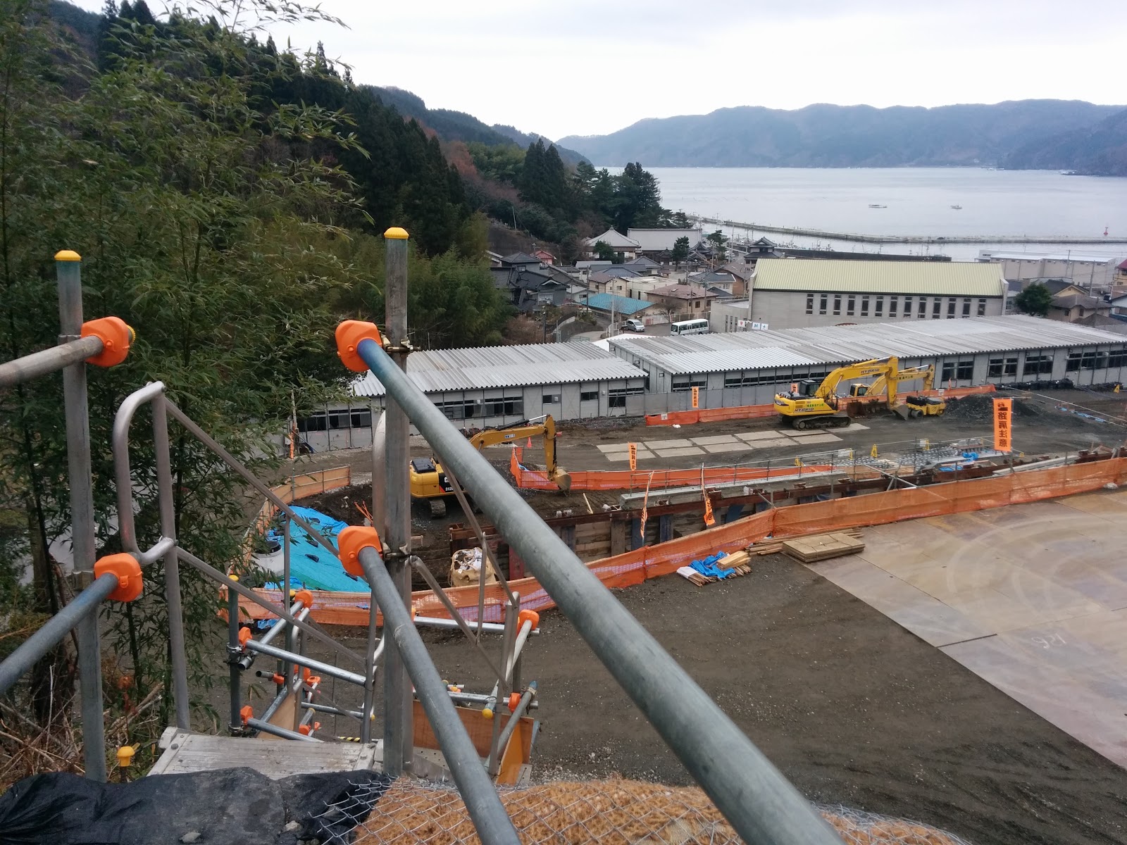
Looking at the harbor from the Onagawa municipal hospital
We stopped in Onagawa very briefly to stop by the municipal hospital where a lot of people fled to. The hospital was situated on a 20 meter high hill, but even so the tsunami ended up flooding the first floor almost up to the second floor. The view from the hill was pretty incredible. You just see a huge swatch of reconstruction, dirt everywhere, bulldozers, flatness, of what used to be buildings, families, livelihoods.
So that’s just a brief tour of the places I’ve been to with regards to the 2011 Tohoku Earthquake and Tsunami. If you want to kind of see for yourself the reconstruction Google street view is pretty great. Not only can you stroll through these towns to get a sense of what I’m talking about but street view also has this feature where you can change the times the street view was taken, and for most of these places I’m talking about they have a timestamp at 2011 right after the disaster and 2014, three years after, so you can compare and contrast.
12/14/2015
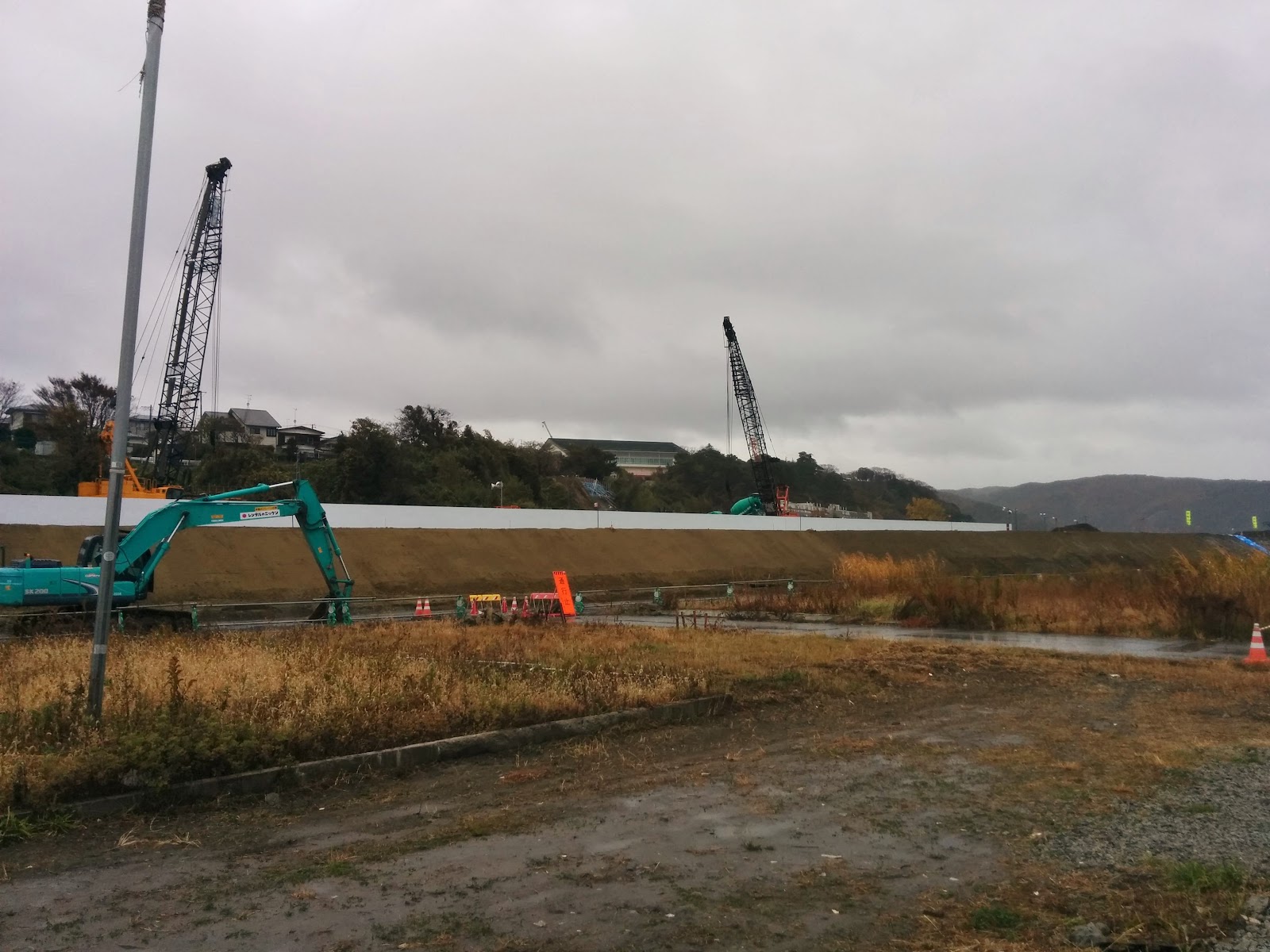
Going to continue writing this post. This time we’re in Kamaishi which is further north in the Iwate prefecture. I was in Kamaishi with my lab conducting a survey of the city’s current reconstruction process. Mainly we went around to every building in the main downtown area and took notes and pictures on things like if it was a vacant lot, old building, new construction, and other details regarding the architecture. It was pretty amazing, I think about ⅓ of the buildings were newly constructed since 2011. We would look at the pre-disaster map with an entire block of residential houses, and then look up to see that entire block turned into a massive parking lot.

A port in Kamaishi, the concrete thing in the front is a tsunami breakwater.
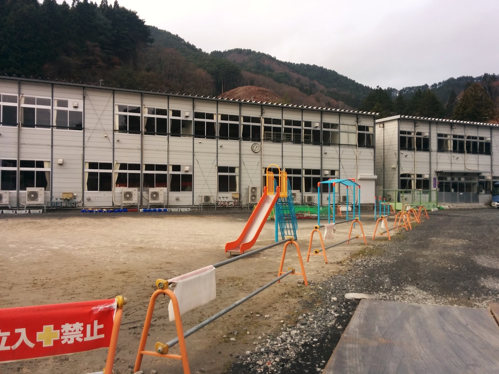
This is a temporary elementary and middle school that the kids are using until a newer one is built
Construction of the new elementary school and middle school behind the old one
So remember the part up there where I talked about temporary homes? The Japanese government is trying to move people out of these temporary homes, but some people just can’t afford it, so in order to transition people out, the government is paying for public housing to be constructed.
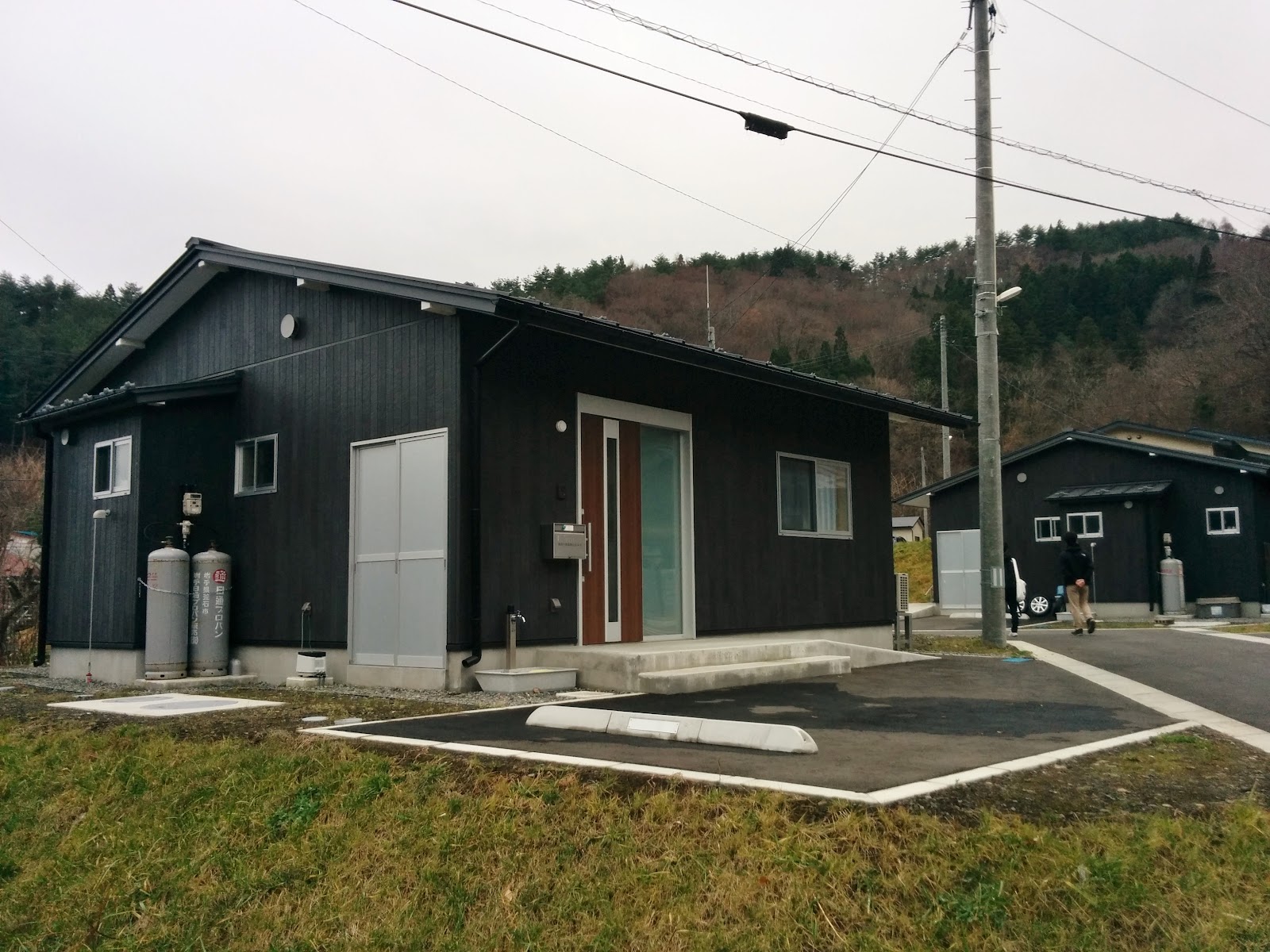
A completed public housing unit in Kamaishi
It’s kind of funny, all the public housing I’ve seen so far is super modern looking, but then you see the front doors open and it’s these old grandmas and grandpas living in these future abodes. This particular house in the picture above is in the countryside of Kamaishi. As Japan’s population continues to decrease, as more and more young people move away from smaller towns into larger cities, it makes me wonder, after the current residents pass away will it just leave a bunch of vacant modern looking houses in the Japanese countryside.

A comparison of what the other houses in this particular area of Kamaishi looks like
No comments:
Post a Comment